Segmented MGRS & UTM display
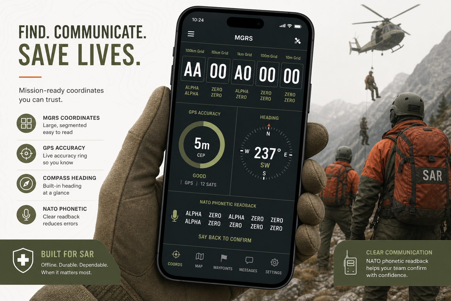
Large, copy-friendly grid readout with NATO phonetic support for radio traffic during active searches.
Local-first iPhone app for SAR & field teams
GridLog: MGRS SAR Handover is built for search-and-rescue personnel, outdoor leaders, and first responders who need readable MGRS coordinates, evidence at every waypoint, and exportable mission records the next team can trust — all stored on your iPhone until you choose to share.
Free training mission · Lifetime Pro unlock · No subscription · iOS 17+
Scroll through real GridLog screens — large MGRS readout, quick logging, evidence cards, and mission handover exports designed for shift changes.
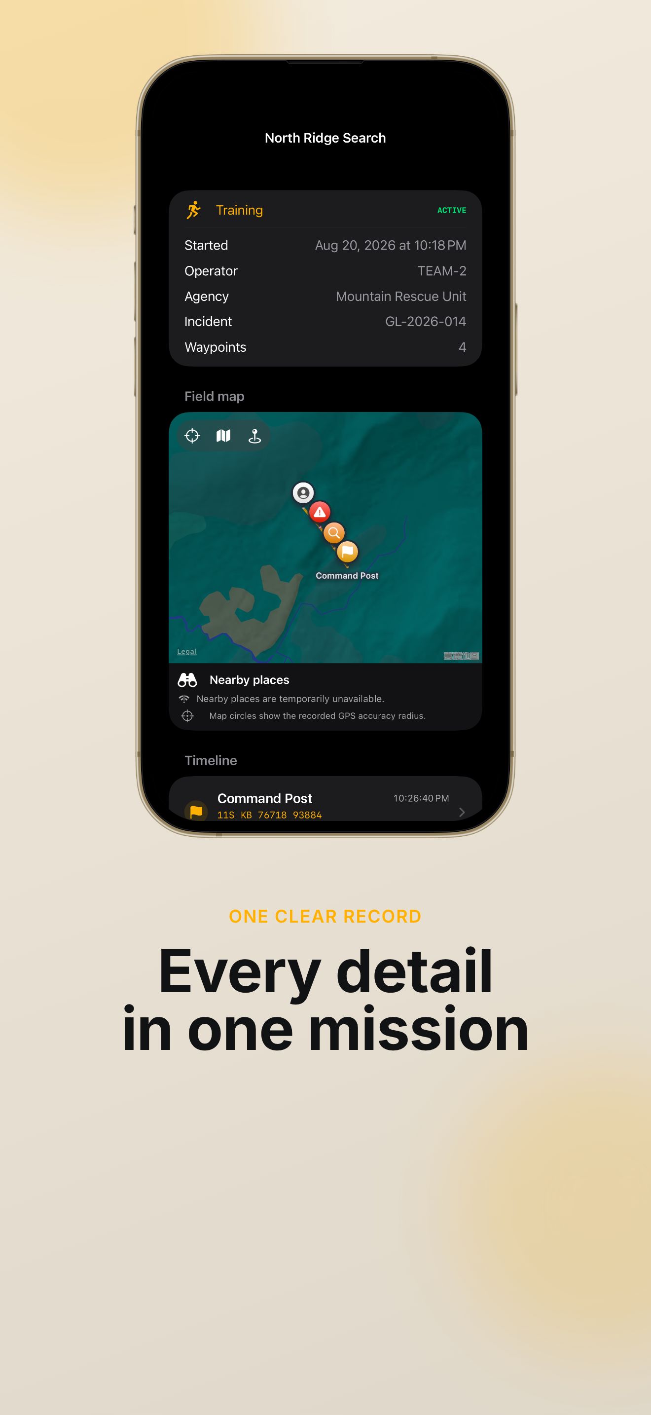
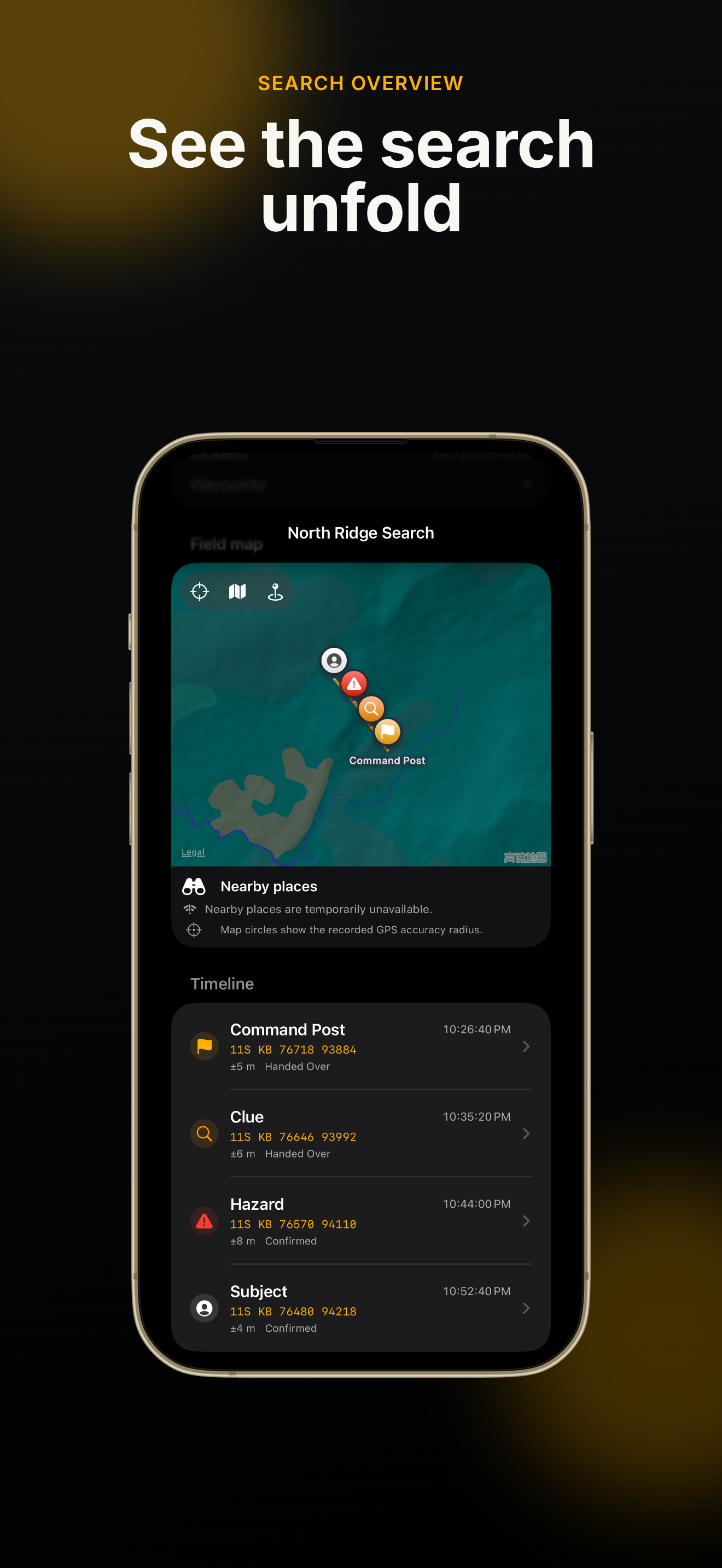
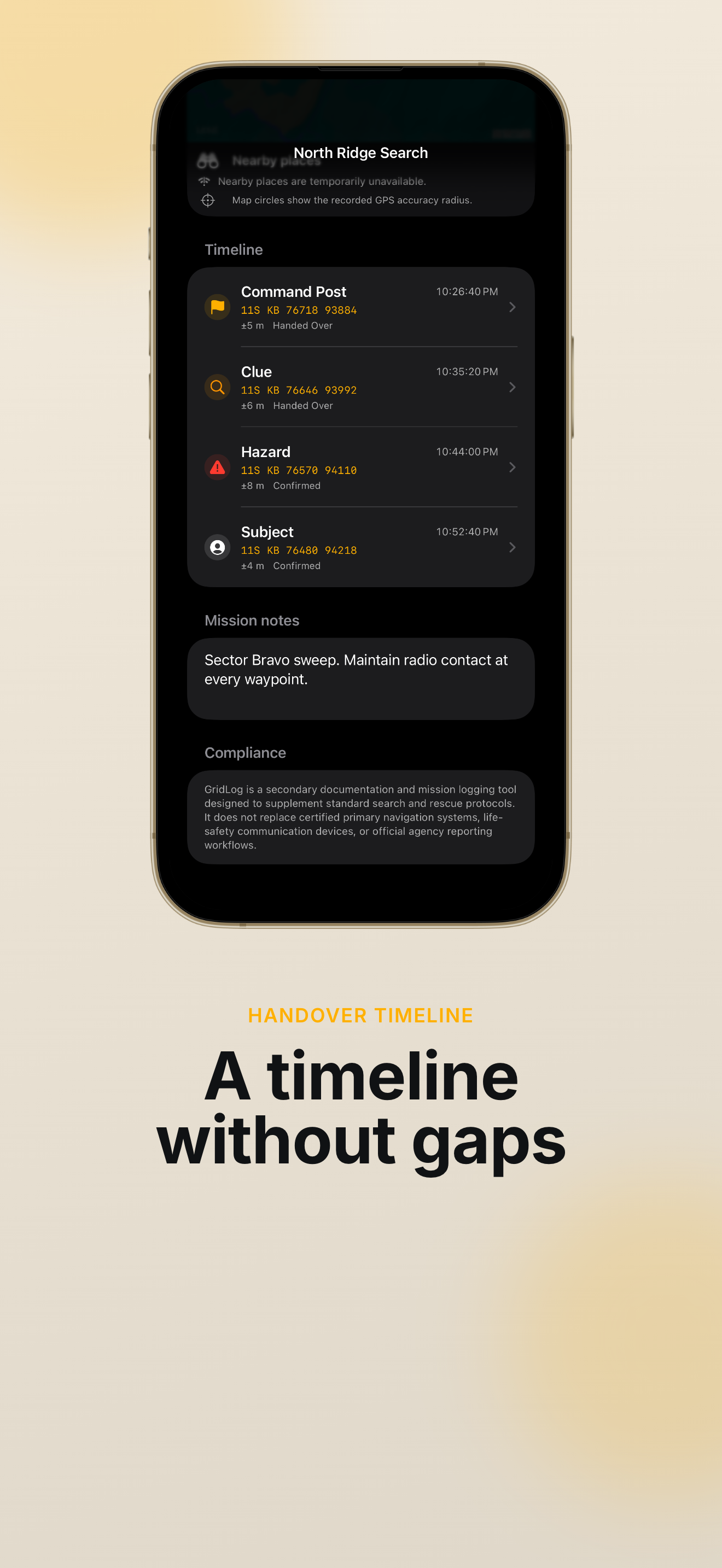
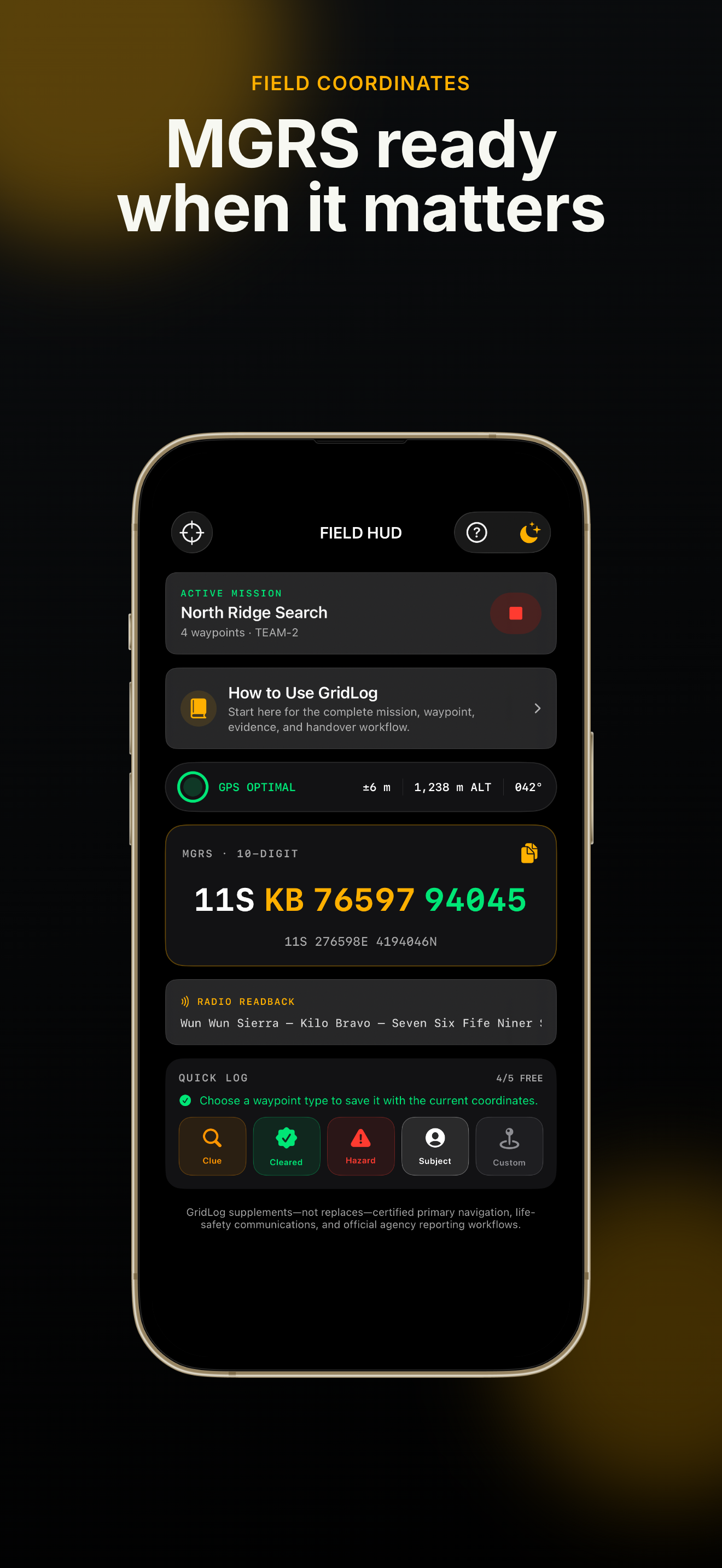
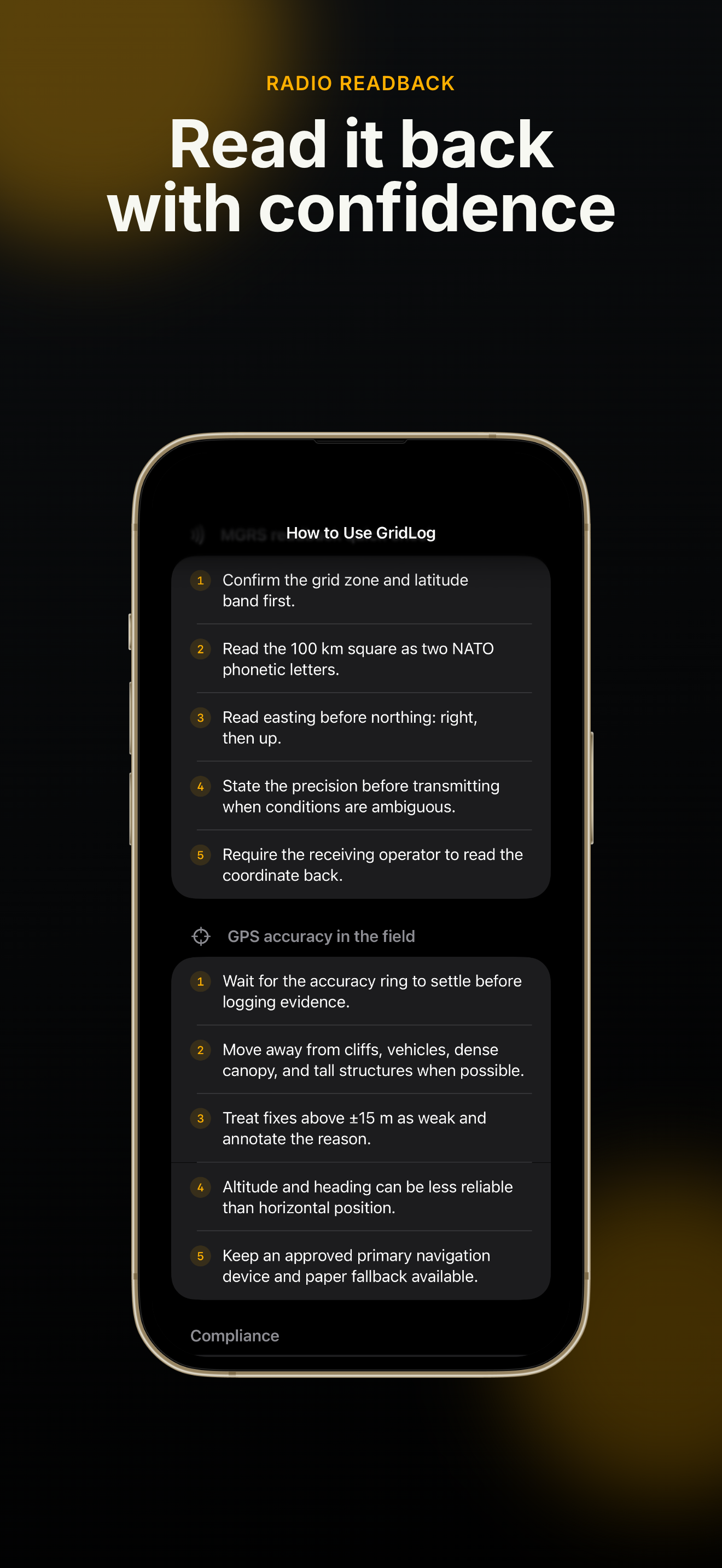
GridLog: MGRS SAR Handover focuses on what matters on scene — readable grids, defensible evidence, and packages the incoming crew can open without guesswork.
Read segmented MGRS and UTM coordinates in large monospaced type, monitor GPS accuracy, altitude, and heading, and use NATO radio readback so coordinates go over the radio cleanly. GridLog blocks misleading fixes when accuracy is poor — because a bad grid in a SAR handover can send the next team the wrong way.
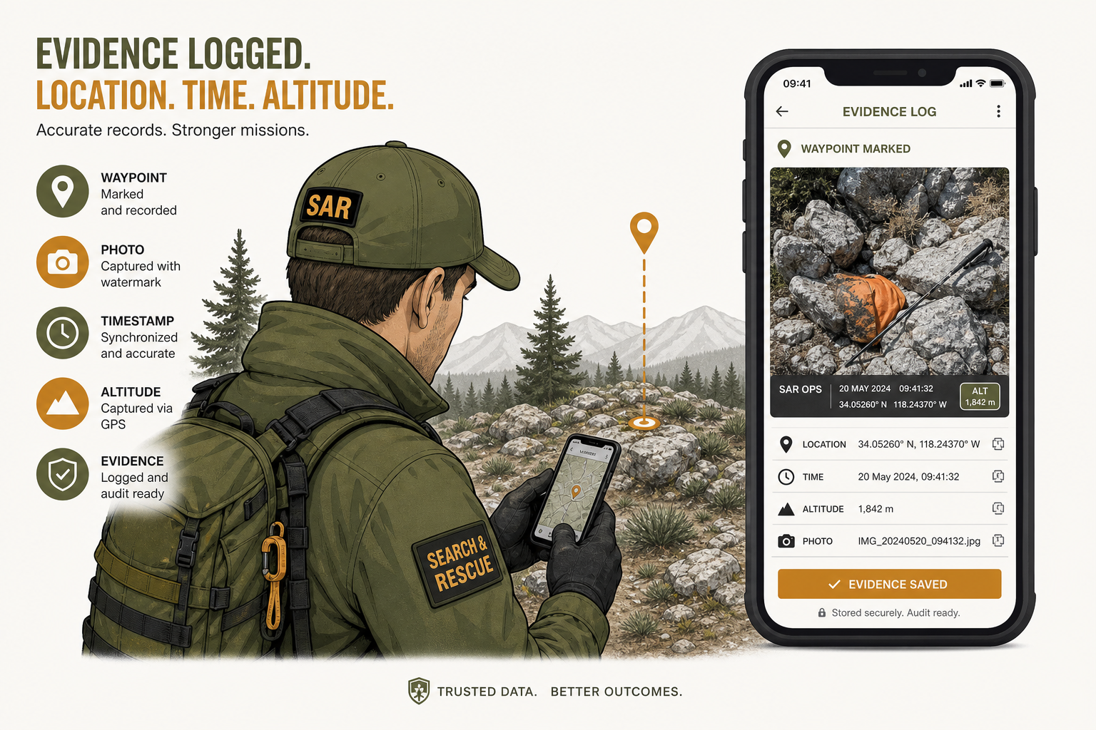
Each waypoint in GridLog: MGRS SAR Handover captures position, UTC and local time, accuracy, altitude, heading, classification, and status. Pro adds watermarked photos, short radio notes, custom labels, and SHA-256 photo integrity checks — so your SAR handover record stands up when questions come later.
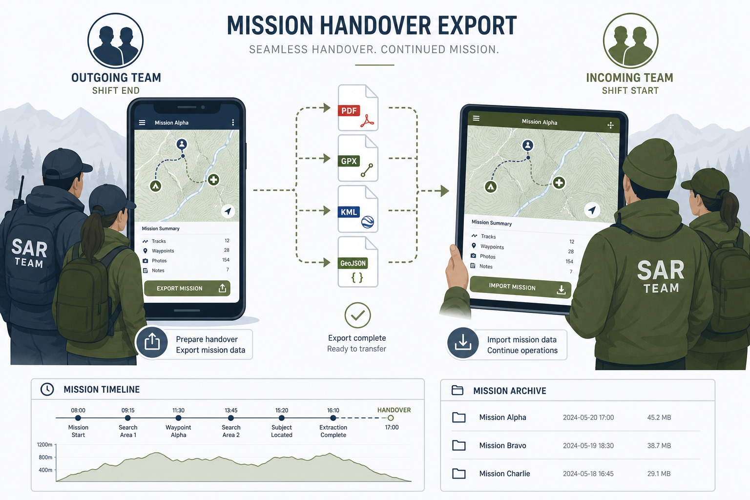
Search your local mission archive, review maps, timelines, incident IDs, and statistics, then export branded PDF and CSV, plus GPX, KML, GeoJSON, and evidence-inclusive mission ZIP files. GridLog: MGRS SAR Handover only sends data when you tap export — ideal for SAR shift changes with spotty signal.
Everything in GridLog is designed around field readability, audit-friendly records, and handover formats SAR teams already use.
Large, copy-friendly grid readout with NATO phonetic support for radio traffic during active searches.
GridLog warns or blocks logging when accuracy is too poor or the fix is stale — reducing bad coordinates in your SAR handover.
One-tap Clue, Cleared, Hazard, Subject, and Custom buttons latch position and time at the moment you need them.
Pro captures photos with embedded coordinate, time, and accuracy metadata plus SHA-256 integrity verification.
Record up to 30 seconds of audio at a waypoint when typing is impractical — stored locally with the mission.
Debrief view with map, timeline, incident ID, stats, duplicate missions, and reusable templates for repeat callouts.
Pro exports operator-branded PDFs and spreadsheet-friendly CSV for agency records and after-action reviews.
Share GIS-ready files with mapping tools your team already uses — no cloud account required.
OLED black, amber, green, and red/green low-light HUD modes for night operations and reduced glare.
A practical GridLog workflow from first fix to handover package — built for crews who cannot afford transcription errors.
Start GridLog: MGRS SAR Handover on scene. Read the segmented MGRS string, check GPS accuracy and fix age, and use NATO readback before radioing coordinates to base or the next team.
Tap quick-log buttons for clues, hazards, cleared areas, or subjects. Add notes, status, photos, and radio notes so each point in your GridLog SAR record carries operational context — not just a pin.
When the shift ends, open Debrief in GridLog: MGRS SAR Handover, review the map and timeline, then export PDF, CSV, GIS files, or a full evidence ZIP. Share only through channels your agency approves.
GridLog stores everything locally until you export. No account, no background upload.
Read GridLog FAQClear answers for SAR volunteers, team leaders, and outdoor professionals evaluating GridLog for field logging and handover.
GridLog: MGRS SAR Handover is an iPhone app for search-and-rescue teams and field leaders. It helps you read and log MGRS/UTM coordinates, capture evidence at waypoints, and export mission packages for the next crew — all stored locally on your device.
Yes. GridLog: MGRS SAR Handover is local-first. Logging, debrief, and archive search work without a network connection. Exports are generated on your iPhone and shared only when you choose. Maps use Apple MapKit and require connectivity for tiles.
No. GridLog is a secondary documentation and mission logging tool. It does not replace certified navigation systems, life-safety communication devices, personal locator beacons, or your agency's official reporting workflow.
The free version of GridLog includes one reusable training mission with up to five text waypoints so you can practice MGRS readout and basic logging before upgrading.
GridLog Pro is a one-time, non-consumable Lifetime purchase through the App Store (currently US$24.99). It unlocks unlimited missions and waypoints, photo and radio evidence, branded exports, GIS files, mission ZIP packages, operator presets, and low-light HUD modes. No subscription.
Mission data stays on your iPhone in local SwiftData storage. GridLog does not require an account or operate a mission cloud backend. Delete missions in the app or remove the app to erase local data.
GridLog Pro exports branded PDF and CSV mission reports, GPX, KML, and GeoJSON for GIS tools, plus evidence-inclusive mission ZIP archives with manifests. You can also export your full multi-mission archive.
Email hi@codemxm.com for GridLog support, feedback, or privacy questions. You can also review our Privacy Policy and Terms of Service on this site.
Download GridLog on the App Store and run a training mission today.
GridLog: MGRS SAR Handover keeps your coordinates readable, your evidence attached, and your handover package ready for the next team.
Requires iOS 17 or later. GridLog is a field documentation tool — always follow your agency's safety and navigation procedures.